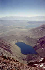
East to Convict Lake and Crowley Lake
Laurel Summit

East to Convict Lake and Crowley Lake

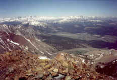
Northwest to Mammoth Mt., upper left, Mt. Ritter and Banner Peak, top left,
the June Lake Loop area , top right, the town of Mammoth Lakes, middle
right, and at the bottom center is the aluminum summit register.
After several attempts on the east face of Laurel Mt. I
finally discovered
the Laurel Lakes road which goes along the NW side of Laurel Mt.
From the first turnoff south of the barbed wire cattle gate it took 3.5 hours
to hike to the top. Driving farther south will not put a person in a better
position
for the summit due to unclimable cliffs on the west face.