Olancha Peak 12,123'
Olancha Peak 12,123'
Olancha Peak is known as the Southern
Sentinel of the Sierras. There is no peak higher, further south in California.
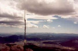
The view is so commanding that the NPS installed a repeater antenna on
the summit. To the east is the southern half of the Owens Valley, the White
Mountain Range, the Panamint Mountain range, and Telescope Peak. To the
north is the Sierra Crestline building up to Langley and Whitney. To the
south is the Sierra Crestline as it diminishes to the Tehachapi Mountains.
To the west is the Kern River watershed and Sequoia National Park and Sequoia
National Forest.
"Exploring the Southern Sierra: East Side"
by JC and Ruby Jenkins gives all the beta for Olancha via the NE Ridge
and comment "Only hikers in top physical condition and skilled in route
finding should attempt this ascent, which is by far the most challenging
climb in this book." I cheated. Doing it in May , I only had 8 hours of
climbing/hiking the first day until I reached snow on the NE ridge and
immediately set up camp at the first snowpatch. The water tasted bad due
to a bunch of dead bugs in the snow that seem to die and drip their innards
down into the snow but it sustained me until I got to a stream 4 hours
into the second day. Anyone making it to the first stream on the first
day is a helluva hiker.The trip took me three days and two nights. 40'
of accessory cord helps for raising and lowering packs over some third
class sections.

Looking SW from the summit, at the NPS antenna and the Kern River drainage.

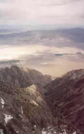
Looking east, down into the Owens Valley,
and the respectable, trailess 8000' elevation gain.

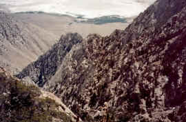
This photo was taken from the NE
corner of the Olancha Summit Plateau and looks down the north side of the south
wall of Cartago Canyon which as far as I know, still has not received a first
ascent. So if anyone is complaining of crowded rock climbing spots, now you know
where to go.